


Monday 4 September 2023
| Distance (km) | 15 kms | |||
| Distance (time) | 8 hrs | |||
| Climb / Descent | 1000m / 1000 | |||
| Hard / Soft surface | 10% / 90% | |||
| Landscape |
|
|||
| Weather |
|
|||
|
|
||||
|
We want to take advantage of the cool morning but still be able to visit the local bakery for food on the way,
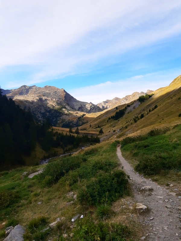
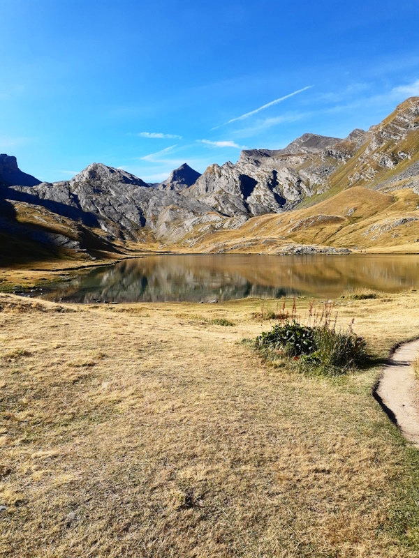
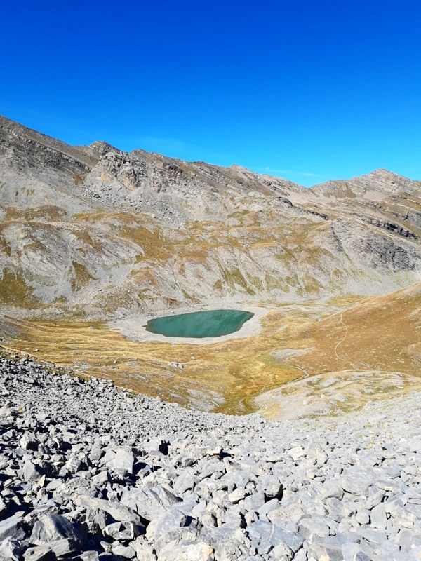
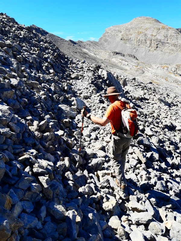
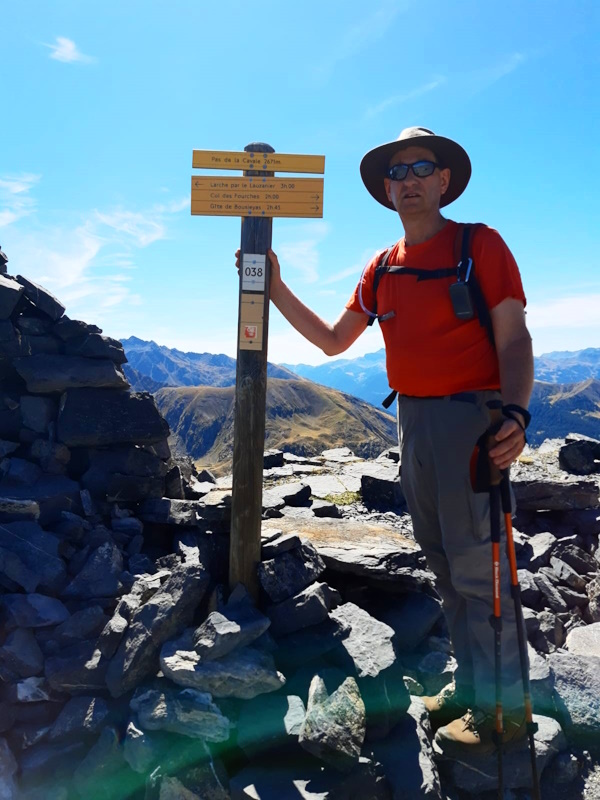
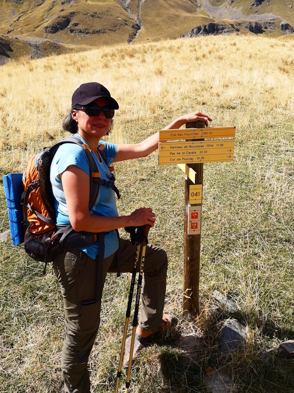
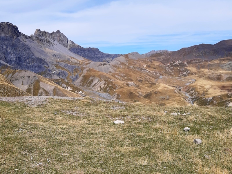
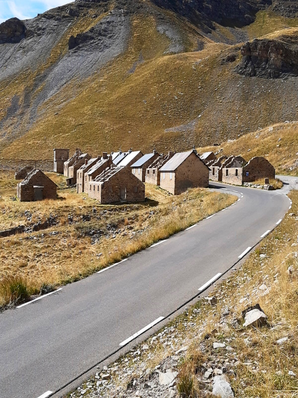
so we started our walk at 8:15 after driving to Pont-Rouge from the camping site in Larche. The first part is a gentle walk over a wide gravel track that is said to be suitable for wheel chairs all the way to Lac du Lauzanier, but getting closer to the lake the path gets narrow, rocky and steep with some serious rock crawling parts. So that claim about wheelchairs being able to make it to the lake...we have our doubts. The lake is beautiful and quiet and we decide to have a short stop for something to eat. Shortly after us a belgium young couple arrives and it seems they even want to prepare some food because they ask us for a lighter. Well, we don't have one, and I don't think it's allowed to make fire here anyway. We get up and continue to the Pas de la Cavale. We start off with another climbing part, but not as steep and rocky as the part just before Lac du Lauzanier. Then we reach a second lake, Lac de derrière la Croix, where the path takes a wide loop around the lake. On the other side it seems to go almost vertically up in a couple of sharp hairpins. It is acutally not that bad as it is still a reasonalby decent path, but since that isn't tiring enough we now have to cross a rather unstable debris slope until suddenly the final 200m to the pass are very easy. Time for another break to have something more to eat. But where is the way down? It feels we have to almost jump over the cliff for a narrow and steep path glued to the vertical rock wall. The first 100-150m are a nightmare; steep, sometimes we literally have to hug the rock wall until we reach another highly unstable debris slope where we actually cause a small rock slide. Then we hit grassy areas again and descending becomes easier, or should I say: less difficult. After an endless descent we reached the lowest point at Salso Moreno (some smarty in an online blog mentions that that means "brown sauce" in Spanish - a) that would then be be Salsa Morena and not Salso Moreno and b) why would something in France that is almost at the border with Italy have a Spanish name?). Anyway, it is a glacial debris field. One more climb to go, but my goodness it's a steep one. Glued to the mountain side and full in the sun without any wind we sweat our way up to Col des Fourches. At the former military barracks here, along the road to the famous Col de la Bonette, we briefly rest in the shadow to have something to drink. From here it's a rather gentle 1 hour descent to Bousieyas where our car is. But not after having a large glass of lemonade at the local gite. First real day done and survived...just. |
        |
|||
|
|
||||
Download track PonBou.gpx